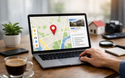
Geotagging images is a simple way to improve your local SEO efforts and help customers find your business. By embedding location data (like latitude and longitude) into your image files, search engines can better associate your business with a specific area. This can boost your visibility in local search results, especially for "near me" queries.
Key Takeaways:
- Geotagging links images to your business location, improving local search relevance.
- While Google doesn’t directly use geotagged data for rankings, platforms like Bing and Yahoo do.
- Tools like GeoImgr, ExifTool, and GPS-enabled cameras make geotagging easy.
- Geotagged images work best when combined with local SEO strategies like consistent NAP details and schema markup.
Caution: Some platforms strip metadata from uploaded images, so geotagging should complement other SEO tactics, not replace them.
What is Geotagging and How Does it Help Local SEO
What is Geotagging?
Geotagging involves embedding geographic coordinates – like latitude, longitude, altitude, compass direction, and even timestamps – directly into an image’s metadata. For instance, a photo of a landmark might include details about its exact location and the time it was taken.
Most smartphones and GPS-enabled cameras handle this automatically when location services are active. These devices use satellite signals to pinpoint your location and store that data in the image’s EXIF metadata. This hidden section of the file also logs technical details, such as the camera settings used when the photo was captured.
Now, let’s look at how this seemingly small detail can make a big difference in local SEO.
How Geotagging Helps Local SEO
Geotagging connects your images to a specific location, helping search engines understand where your business operates. When used in your Google Business Profile or local directory listings, these geotagged images add another layer of location context, boosting your geographic relevance online. This can improve your chances of appearing in map-based searches or location-specific image results, making it easier for potential customers to find you.
Geotagged images also have the potential to show up in location-based photo searches or map applications, offering yet another way for people to discover your business.
That said, while geotagging can be a helpful tool, it’s not without its challenges.
Geotagging Limitations to Know
Despite its benefits, geotagging has some drawbacks. Many platforms, including social media sites and content management systems, often strip away metadata – like geotag information – from uploaded images. For instance, Google Business Profile removes EXIF data from photos added to business listings. Similarly, platforms like Facebook, Instagram, and Twitter erase this metadata, mainly for privacy and performance reasons.
Because of these limitations, geotagging works best as part of a broader local SEO strategy rather than a standalone tactic. It should complement other efforts, such as maintaining consistent NAP (Name, Address, Phone) details, using local schema markup, and creating location-focused content.
Privacy is another factor to keep in mind. If your photos include customers or sensitive areas of your business, think carefully about the location information you’re sharing publicly. Many businesses choose to geotag only exterior shots or general area photos to avoid revealing too much about specific interiors or private spaces.
How to Geotag Images for Local SEO – (Fast, Bulk upload) 2020
Tools for Geotagging Images
Using the right geotagging tools can simplify your workflow and ensure your images include the location data necessary for boosting local SEO. With the location intelligence market valued at $21.21 billion in 2024 and projected to grow at a 16.8% annual rate from 2025 to 2030, it’s clear that businesses are increasingly recognizing the importance of location-based data.
Best Geotagging Tools
GeoImgr is a widely used desktop app that allows you to add coordinates manually or by selecting points on an interactive map. It supports formats like JPEG, PNG, and TIFF. To protect your original files, the software creates geotagged copies, minimizing the risk of accidental data loss.
ExifTool is perfect for those comfortable with command-line operations. This free tool is designed for processing large batches of images and supports a wide range of formats. While it does require some technical expertise, it offers precise control over metadata editing, making it a go-to option for managing extensive image collections.
Smartphones and GPS cameras are great for real-time photography, as they automatically embed location data when location services are active. However, for older image libraries, you may need to manually edit the metadata.
Online EXIF editors, such as Pic2Map, provide a browser-based solution that doesn’t require any software installation. These tools are ideal for occasional use – just drag and drop your images for quick geotagging. However, they may have file size limits and require an internet connection.
Each of these tools serves different needs, so it’s worth assessing which one aligns best with your workflow and file format requirements.
How to Choose the Right Geotagging Tool
Selecting the right tool largely depends on your volume of images and integration needs. If your business processes dozens of images weekly, user-friendly desktop apps might be sufficient. For those managing hundreds of photos, tools with robust batch processing capabilities, like ExifTool, are more suitable. Additionally, if you already use GIS platforms like ArcGIS or AutoCAD, opt for tools that integrate well with these systems.
Accuracy requirements are another factor to consider. For example, a restaurant chain might need precise geotagging for each location, while a regional service provider may only need general area tagging. Tools with real-time GPS integration often meet the precision standards needed for local SEO.
Budget is also key. Many excellent geotagging features are available for free, so it’s wise to test these options before committing to premium software. Paid tools often include advanced features and dedicated customer support, which can be invaluable for busy marketing teams.
Choosing the right tool not only saves time but also strengthens your local SEO efforts.
Geotagging Tool Comparison
Here’s a side-by-side comparison to help you decide:
| Tool | Best For | File Formats | Batch Processing | Learning Curve | Cost |
|---|---|---|---|---|---|
| GeoImgr | Small businesses, manual tagging | JPEG, PNG, TIFF | Limited | Easy | Free |
| ExifTool | Large volumes, technical users | All major formats | Excellent | Steep | Free |
| GPS Camera Apps | Real-time photography | JPEG, HEIC | No | Minimal | Free |
| Online EXIF Editors | Occasional use, no installation | JPEG, PNG | Limited | Easy | Free–$10/month |
| Professional GIS Software | Enterprise, complex workflows | All geospatial formats | Excellent | Steep | $100–$500/month |
Data security is another critical consideration, especially if you’re handling sensitive business locations or customer photos. On-premise solutions often provide better control over your data compared to cloud-based tools. For industries with strict security requirements, enterprise-grade tools offer encrypted storage and detailed permission settings.
The transportation and logistics sector accounts for 19.4% of the location intelligence market, as precise geotagging is essential for their operations. Similarly, sales and marketing professionals make up 20.7% of users, leveraging these tools for targeted campaigns and segmentation. If you’re in these fields, look for tools with advanced analytics and integration features.
Before committing to a tool, test it with your image library. Upload a sample batch to different platforms after geotagging to confirm that the location data is retained. This hands-on testing ensures the tool works smoothly with your website or social media platforms.
How to Geotag Images: Step-by-Step Process
Adding precise location data to your images can enhance your local SEO efforts. Here’s a clear guide to help you geotag your photos effectively.
Getting Images Ready for Geotagging
Start by selecting high-quality JPEG images, at least 1,200 pixels wide, that showcase your business. These could include photos of your storefront, interior spaces, or key service areas. For example, a landscaping company might use before-and-after shots of local projects or photos of their team working in recognizable neighborhood spots.
Before making any changes, create backup copies of your original images. Store these backups in a separate folder labeled with the current date to ensure you can always revert to the originals if needed.
If you manage multiple business locations, organize your images by location. Create folders named after each site, such as "Downtown_Store" or "North_Branch_Photos." This will help you stay organized and avoid applying the wrong coordinates to your images.
Check the file sizes of your images before starting. Most geotagging tools work best with files under 10MB. If your images are larger, resize them using basic photo editing software while maintaining a width of at least 1,200 pixels to preserve quality.
Adding Location Data to Images
First, determine your exact coordinates. Use Google Maps to locate your business address, right-click on the precise location, and copy the latitude and longitude. For instance, a coffee shop at 123 Main Street might have coordinates like 40.7589, -73.9851.
Next, open a geotagging tool like GeoImgr and drag your image into the application. The tool will display your photo alongside an interactive map. Click on your business location on the map or manually enter the copied coordinates into the latitude and longitude fields.
In the metadata fields, add descriptive location details, such as your business name, address, city, and state. For example, a restaurant could include "Tony’s Pizza – 456 Oak Avenue, Springfield, IL" in the description. This extra information helps search engines pinpoint where the image was taken.
Double-check the map pin to ensure it’s placed precisely on your business address. Zoom in to street level for accuracy, as even small deviations can impact local search results.
Once done, save the geotagged image with a new filename. Adding a suffix like "_geotagged" (e.g., "storefront_photo_geotagged.jpg") makes it easy to identify which files include location data. If you’re working with multiple images from the same location, use batch processing to apply the same coordinates efficiently.
After geotagging, your images are ready to be uploaded to your digital platforms.
Uploading Geotagged Images to Your Platforms
Before uploading, test one geotagged image to confirm that the location data is retained. Use browser developer tools or EXIF viewing websites to check the metadata. Some content management systems strip metadata during upload, which would negate the benefits of geotagging.
Once verified, incorporate the geotagged images into your website and business listings. For your website, use these images on location-specific pages. For instance, add a geotagged photo of your storefront to your "Contact Us" page or include service-related images on pages targeting specific neighborhoods.
Upload geotagged images to your Google Business Profile to strengthen your local SEO. Google can read the embedded location data, further associating your business with its physical address. Place these images in relevant categories like "Interior", "Exterior", or "At Work."
To retain quality, always select the highest resolution settings when uploading. Social media platforms like Facebook and Instagram often compress images, so starting with high-resolution, geotagged photos increases the chance that useful metadata remains intact.
By embedding accurate location data in your images, you can reinforce your business’s local presence and improve search visibility.
For more tailored local SEO strategies, check out the resources available from SearchX.
Best Practices for Geotagged Images
When used effectively, geotagged images can significantly improve your local search rankings. By following these best practices, you can ensure search engines pick up on your location signals and boost your visibility.
Where to Use Geotagged Images
The most impactful place to showcase geotagged images is your Google Business Profile. Upload photos of your storefront, interior spaces, team members, or products to clearly establish your business’s location. These images help reinforce your presence in the local area. Similarly, adding geotagged photos to your website’s location-specific pages can further emphasize your relevance. For instance, a plumbing service operating in multiple areas could include project photos on landing pages tailored to specific neighborhoods or zip codes.
Local directories like Yelp, Yellow Pages, and other niche platforms also benefit from geotagged images. These directories often highlight photos in search results, and the embedded geolocation data strengthens your business’s connection to the area. Social media platforms, such as Facebook and Instagram, offer another opportunity. By manually adding location tags to your posts, your images can appear in local hashtag searches and location-based feeds. This approach works particularly well for promoting local events, showcasing community involvement, or highlighting location-specific services.
To amplify these efforts, consider incorporating schema markup alongside geotagged images.
Using Schema Markup with Geotagged Images
Pairing geotagged images with LocalBusiness schema markup creates a powerful combination for local SEO. The structured data provided by schema markup works hand-in-hand with the geolocation signals in your images, offering search engines both visual and textual confirmation of your business’s location.
To implement this, use the ImageObject schema within your LocalBusiness markup to spotlight geotagged photos. For businesses with multiple locations, you can take it a step further by using Organization schema with location-specific details. For example, a restaurant chain might create separate schemas for each location, featuring geotagged photos of the interior and exterior for each address. This approach not only reinforces your location data but also highlights the specific services available at each site.
By combining schema markup with geotagged images, you can help search engines better understand where your business operates and what you offer, giving you an edge in local search results.
Keeping Business Information Consistent
After optimizing your images and schema, maintaining consistency in your business information is critical. Ensure that your NAP (Name, Address, Phone number) details are uniform across all platforms, including your website, Google Business Profile, and directory listings. The location data embedded in your geotagged images should match this information exactly.
For example, if your business coordinates are listed as 40.7589, -73.9851, all geotagged images for that location should use these precise values. Even slight discrepancies can confuse search engines. Similarly, your business name should be formatted consistently. If your Google Business Profile lists "Tony’s Pizza Restaurant", avoid variations like "Tony’s Pizza" or "Tony’s Italian Restaurant" in your image metadata. Phone numbers should also follow the same format across all platforms, such as (555) 123-4567.
Regularly auditing your geotagged images is essential to maintain accuracy. Check that each photo still contains the correct location data and aligns with your current business details. If your business moves or undergoes rebranding, update your image metadata promptly to reflect these changes.
Tracking Results from Geotagged Images
After incorporating geotagged images into your platforms, it’s time to evaluate their impact. Tracking their performance helps you understand if they’re driving local traffic and boosting search rankings.
Using Analytics to Track Traffic and Rankings
Analytics tools like Google Analytics and Search Console can provide a clear picture of how geotagged images influence local traffic. In Google Analytics, check the geographic reports under the Audience section to see if you’re attracting more visitors from your target locations. Pay close attention to organic traffic trends from users in your service areas after implementing geotagged images.
Google Search Console, on the other hand, offers insights through its Performance report. Filter data by location to analyze how your site is performing in specific regions. Look for increases in impressions and clicks for location-based queries, such as “plumber near downtown Chicago” or “bakery in Brooklyn.” The Pages report can also highlight which location-specific landing pages are gaining traction after adding geotagged images.
Additionally, monitor your Google Business Profile for metrics like image views and search queries to cross-verify your data.
If you want deeper insights, consider specialized tools that track key performance indicators, including:
- Improvements in local search rankings
- Increased visibility in Google Maps results
- Higher click-through rates for location-specific searches
- Better engagement with geotagged social media content
- Enhanced conversion rates from local traffic
To dig even deeper, create custom segments in Google Analytics to isolate traffic from your primary service areas. This allows you to track metrics like session duration, pages per session, and conversion rates specifically for local visitors, giving you a clearer picture of how geotagged images are impacting engagement.
These analytics provide a foundation for refining your local SEO strategies.
Measuring Impact on ‘Near Me’ Searches
Building on your analytics data, focus on tracking ‘near me’ searches to understand how geotagged images are influencing immediate local engagement. These queries, like “restaurants near me” or “auto repair near me,” often lead to high-intent actions such as phone calls, driving directions, or store visits. Geotagged images can play a significant role in increasing your visibility in these results.
Google Search Console’s Search Analytics is a great tool for identifying which “near me” queries are driving traffic to your site. Track metrics like average position and click-through rates for these terms to measure performance.
Your Google Business Profile is another valuable resource. It provides data on calls and direction requests, which are often tied to immediate ‘near me’ searches. Monitoring these numbers weekly can help you identify trends related to your geotagged image efforts.
Social media platforms also provide helpful location-based insights. For example:
- Instagram’s location tags show how geotagged content is performing in local discovery.
- Facebook’s check-in data can reveal how users are engaging with your geotagged posts.
- Hashtag performance for location-specific tags like #ChicagoPizza or #BrooklynCoffee can indicate whether your images are reaching the intended audience.
Keep in mind that platform responses may vary. Mobile searches tend to show stronger engagement with geotagged content, as mobile users often look for immediate, location-based solutions. Desktop searches, however, may reflect different patterns, focusing more on research and comparisons.
Patience is key when measuring the performance of geotagged images. Search engines need time to process and index your location data, so meaningful results typically appear within 4-8 weeks of consistent implementation. Start by tracking your baseline metrics before adding geotagged images, then monitor changes monthly to identify trends and opportunities for improvement.
Use these insights to fine-tune your geotagging strategy and improve your local visibility over time.
Getting the Most from Geotagged Images in Local SEO
Geotagged images are a powerful tool, but they really shine when part of a well-rounded local SEO strategy. While adding location data to your photos can improve visibility, combining geotagging with other local SEO techniques amplifies the signals you send to search engines.
Start by refining your overall SEO efforts with focused content and keyword strategies. Optimizing your web pages to match local search intent is essential. Incorporate neighborhood names, nearby landmarks, or region-specific terms into your content. Pairing geotagged images with these optimized pages sends a clear message to search engines about your business’s location and its relevance to local searches.
Your keyword strategy should complement your geotagged content. Think beyond generic terms like "pizza restaurant" and target more specific phrases, such as "deep dish pizza in Lincoln Park" or "late-night pizza delivery in Wicker Park." When geotagged images are added to pages optimized for these targeted keywords, it reinforces your business’s connection to the area.
Building local backlinks can further amplify the impact of geotagged images. Links from local businesses, community organizations, or chambers of commerce signal to search engines that your business is deeply rooted in the area. When these trusted local websites link to pages featuring your geotagged images, it boosts your local search authority.
Don’t overlook technical SEO basics either. Ensure your website loads quickly, especially on mobile devices where most local searches happen. Compress your images to maintain fast load times and use structured data markup to help search engines understand the relationship between your images, location, and business information.
Timing is key. Roll out these strategies in steps. Begin with content optimization and keyword targeting, then add geotagged images to your most important pages. Gradually build local backlinks while keeping an eye on your site’s technical performance. This phased approach allows you to see what works best for your business.
SearchX’s local SEO solutions combine geotagging, keyword research, content optimization, and technical audits to deliver measurable results. By integrating these tactics, businesses can boost local search visibility, attract more qualified traffic, and drive conversions. Together, these efforts create a strong foundation for local SEO success.
Consistency across all platforms is crucial. A unified strategy helps search engines confidently associate your business with specific locations, improving your rankings for local searches.
FAQs
How can I make sure my geotagged images keep their metadata when uploading to different platforms?
To keep the metadata intact on your geotagged images when uploading them to different platforms, here are a few practical tips:
- Use proper export methods: Skip drag-and-drop uploads, as these can strip away metadata. Instead, rely on software or tools specifically designed to preserve EXIF data during the export process.
- Embed metadata beforehand: Utilize geotagging tools to embed location data directly into the image’s EXIF file before uploading. This ensures the information stays with the image.
- Review platform settings: Be aware that some platforms automatically remove metadata for privacy reasons. Check the upload settings to confirm whether metadata retention is an option.
These steps can help you safeguard your geotagged data, which can be a valuable asset for boosting your local SEO.
How can I use geotagged images to boost my local SEO efforts?
To make the most of geotagged images in your local SEO efforts, start by embedding geotags – such as latitude, longitude, and location details – into your image metadata. Pair this with descriptive filenames and alt text that include local keywords tied to your business and its location. It’s also important to ensure your geotagged images match the details in your Google Business Profile, like your business name, address, and phone number (NAP).
For maximum impact, use geotagged images alongside other local SEO tools, including localized content, customer reviews, and consistent NAP details across all platforms. This well-rounded strategy not only boosts your local search rankings but also reinforces your presence in your target area.
How do I track the impact of geotagged images on my local search rankings?
To understand how geotagged images influence your local search rankings, keep an eye on your Google Business Profile performance. Focus on metrics tied to "near me" or location-specific searches. After uploading geotagged images, see if there’s a boost in rankings for local keywords.
Additionally, use analytics tools to track shifts in local website traffic, user engagement, and conversions. Pay attention to trends like increased click-through rates or a rise in inquiries from nearby customers. While geotagging can improve local relevance, its impact isn’t guaranteed. Pair it with other local SEO tactics to maximize your results.